This interactive map tracks COVID-19 outbreaks in Hamilton
- Michael Kras
- 14 Dec 2020
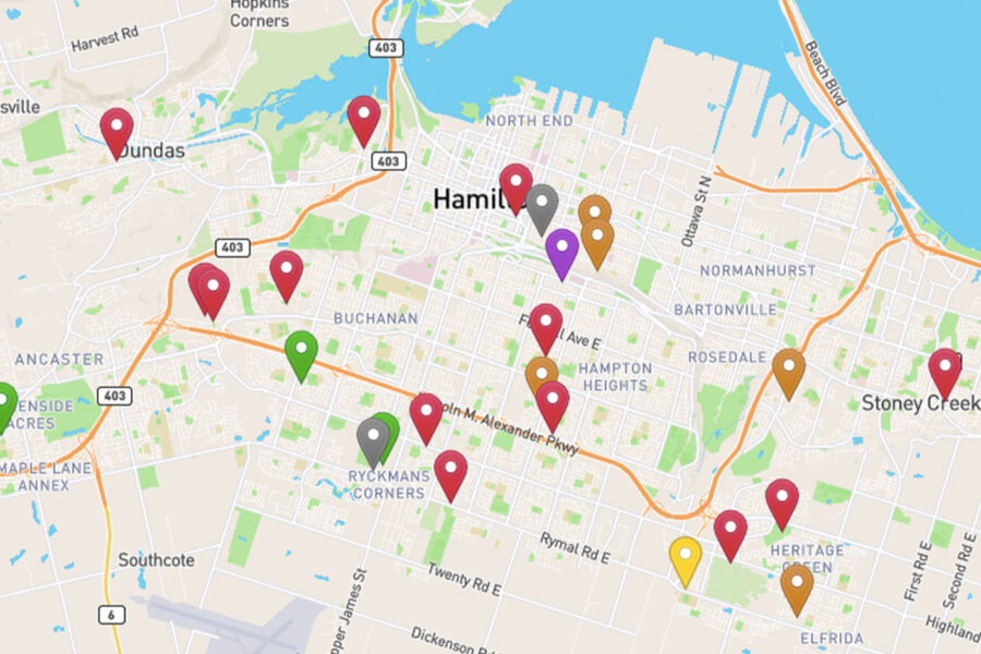
Want a more visual sense of where Hamilton’s COVID-19 outbreaks are located? A new interactive map has just been created that shows the location of the city’s active outbreaks in places like long-term care facilities, schools, and businesses.

The map was created by Hamilton resident Ryan McGreal, who wanted to present the city’s outbreak data in a format that’s easier to comprehend.
“The City of #HamOnt page for #COVID19 outbreaks isn’t super-usable, so I decided to make a page that plots them out on a map and in a data table,” said McGreal in a tweet that also includes a link to his map.
The City of #HamOnt page for #COVID19 outbreaks isn't super-usable, so I decided to make a page that plots them on a map and in a data table.https://t.co/nqBSV5UI0Y pic.twitter.com/0iZUbrQvOq
— Ryan McGreal (@RyanMcGreal) December 13, 2020
The map shows colour-coded pins indicating the location of each active outbreak, with each colour representing a different sort of institution including schools & daycare centres, hospitals, businesses, long-term care homes, and residences. A grey pin indicates an outbreak that is considered resolved.
Hamilton currently has 23 active outbreaks of COVID-19, with the largest at Grace Villa on Upper Gage with a whopping 132 cases including 77 residents and 55 staff; the largest outbreak in Hamilton since the start of the pandemic.
Check out the Hamilton COVID-19 outbreaks map here.
Comments 0
There are no comments
Add comment